
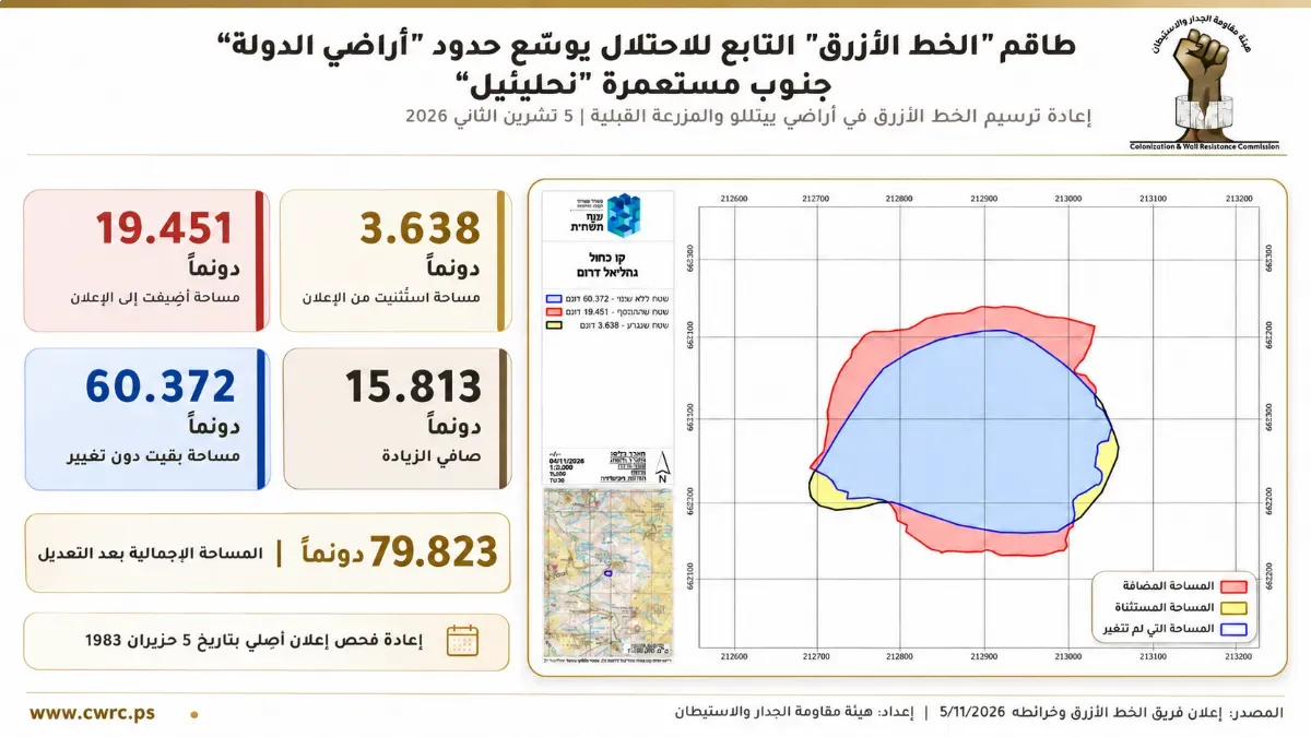
The Wall and Settlement Resistance Commission revealed that Israeli occupation authorities issued a new declaration expanding the boundaries of land classified as state land south of the Nahaliel settlement, built on citizens' land northwest of Ramallah, following a re-examination of a previous declaration dating back to 1983.
The commission explained in a statement on Friday that the declaration covers the lands of the towns of Beitillu and Al-Mazra'a al-Qibliya, and adds 19,451 dunams to the scope of the previous declaration, raising the area covered by the new delineation to 79,823 dunams.
It noted that the measure is based on the work of the so-called Blue Line Team, which is tasked with re-examining and delineating the boundaries of land previously declared state land by the occupation authorities.
The commission warned of the repercussions of expanding the scope of land classified in this way around the Nahaliel settlement, within the Talmon bloc, given what this represents in terms of strengthening colonial control over the surrounding lands, threatening agricultural land and the urban expansion of Palestinian villages, and deepening their geographic isolation.
It added that the new declaration comes days after another declaration that covered 2,536.44 dunams of land in Beitillu, Al-Mazra'a al-Qibliya and Deir Ammar, in an indication of the intensification of land seizure measures northwest of Ramallah.